


.jpg)
.JPG)


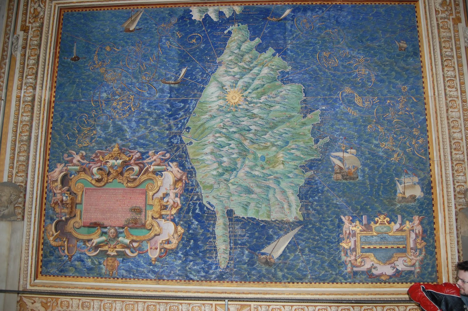
The Island of Corsica from the Gallery of the Maps
painted by Friar Ignazio Danti
(Savage included, not to scale)
One of the many wonders of the Vatican Museums and there are many of those, is the gallery of maps. A hundred and thirty yards long and the gallery features forty frescoes depicting the regions of the Italian peninsula. The frescoes were painted in 1580 by Friar Ignazio Danti over a period of eighteen months, based on preliminary sketches made on the ground. The good friar would climb the highest point near to the largest city or town in the area and draw what he saw. He would then travel to the next highest spot and repeat the process until he felt he had enough material to go on.
The result is a strange admixture of map and painting that is beautiful to behold and surprisingly accurate.
Large towns and fortresses (particularly fortresses) are depicted in inset panels, reminding the viewer that these were tools of state as well as works of art. I also came across additions along the edges of the frescoes, the battle of Lake Trasimere (I think, I forgot to take a picture), depicted as a late renaissance battle, with pike blocks and reiters on the flanks.
Points that struck me about the maps were...
- how accurate they were, one of the curators told me that there had been a project to compare the frescoes with Google maps and thus far the frescoes have been found to be 85% accurate.
- while the relief and the major towns and cities, lakes, etc are present, there is almost no indication of the extent of agriculture, forestry and something I would have thought very important, roads.
While it is very hard to picture the gallery as it would have been, a place of quiet reflection on matters of state while it is thronged with tourists, there is a sense of being very close to the past there.
Hehehe...are you sure it's not a life-drawing of an angel-fish!!! Looks just like one...
ReplyDeleteI love old maps, but was not aware of that gallery. Very cool!
ReplyDeleteYeah, they didn't put roads on a lot of old maps. I think roads weren't always considered as important as we're used to thinking of them these days. Especially given that travel by road was not always very efficient in earlier centuries. Often rivers were more important for major long distance transport.
I have the book which reproduces these maps if you want to have a gander.
ReplyDeleteYou'll notice that there are roads on some of the maps (but not on out of the way places like Sardinia). I presumed they had to be decent/important roads to rate inclusion